Better Decisions Through Traffic Data
The state of Tyrol is currently creating a new digital traffic model in cooperation with the city of Innsbruck in order to better assess traffic measures and their effects across the entire federal state. Salzburg Research was commissioned to create an objective data basis for this with a tailor-made evaluation of real Floating Car Data (FCD).
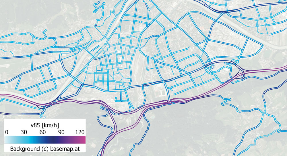
How fast do vehicles really drive on different road sections? The maximum permissible speed cannot actually be driven on every route – for example on very winding routes in alpine regions. Realistic speeds and therefore real vehicle times are essential for sustainable decisions in traffic planning. “We want to use real data to improve the quality of traffic modeling in the Tyrol and the city of Innsbruck. With realistic speeds, we can, for example, better estimate traffic loads and the resulting emissions and also better assess infrastructure measures”, says Marcel Kelterer, traffic planner in the Office of the Tyrolean State Government.
As part of the EVIS.AT traffic data platform, Salzburg Research has been analyzing more than 2 million kilometers of real driving data in Austria and Bavaria every day since 2015. Relevant traffic parameters such as real driving speeds and time-dependent speed profiles of the past twelve months have now been calculated for the State of Tyrol from this large amount of data and made available referenced to the digital map basis GIP (graph integration platform). The entire model-relevant transport network with road classes 0 to 8 was taken into account – from the motorway to roads in local areas, including access routes.
Are you also interested in better decisions based on traffic data? Contact us!


